Saturday, May 19, 2018

All about ME! (part 1)

Yay, we made it to Maine!  We spent about six weeks there, exploring the lower bays from Portland on Casco Bay north through Penobscot Bay, and as far north as Somes Sound in Mt Desert Island in Acadia NP.  The distance from Portland to Mt Desert Island is not even a hundred miles, and so to spend so much time is a small cruising area meant we got to slow down and really enjoy ourselves.

One major adjustment when cruising in Maine is learning to avoid the lobster pots.  They are everywhere!!  Here was a noticeably dense section on our way to an anchorage in Quahog Bay. 


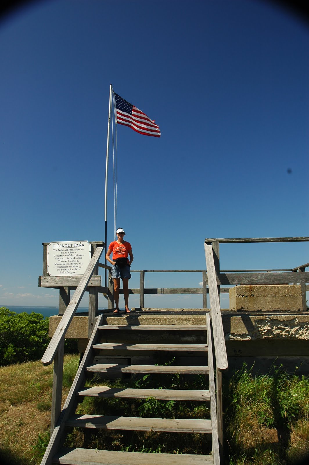
One of our first stops, and one that really set the tone of cruising in Maine, was Jewell Island on Casco Bay.  It is only about 6 miles from Portland, making it a wildly popular weekend stop, but on the weekdays, it was busy but still manageable.  It was here that we were introduced to the Maine Island Trail Association, an organization that maintains access to various coastal islands for camping and hiking.   There were some interesting WWI and WWII lookout towers on Jewell Island to explore, and generally, a cool little spot to hang out.

A view out from the tower offered a nice view of Casco Bay.


View of our small, and a bit busy, anchorage at Jewell Island (Tatiana is center and at the back).  There would be at least three more boats packed in here before nightfall.


We enjoyed exploring the rugged shoreline around the anchorage.


Just east of Jewell Island, we stopped at Eagle Island SP, which maintains the historical home of North Pole Explorer Robert Peary.  It is a remarkable house and setting and the story of this Arctic adventurer was fascinating.


Leaving Eagle Island, we headed east as we departed Casco Bay.  We made several stops along this section of coastline.  We passed through Quahog Bay and Sequin Island on our way to Boothbay Harbor. 

Seguin Island is home to the Seguin Island Lighthouse, which is now illuminated with electricity, and so the lighthouse keepers are no longer needed.  Instead, the home has been converted to a museum and volunteer caretakers residence.  The views here were breathtaking, and the wild roses, raspberries and blueberries were marvelous. 

Here's a view from offshore looking toward the island and lighthouse. 


Lighthouse and caretakers home.  


We stopped in several other bays along the shore, but were ultimately making our way to Penobscot Bay.  This large bay offers semi protected waters. We still ran into a fair bit of fog, and while mostly not interesting to look at, we did occasionally get to see the low fog clouds in the distance, which were quite fun to watch as they meander. 


As we entered Somes Sound on Mt Desert Island, there was a sailboat race going on through in the fog.  Somehow, this felt strangely familiar.


Anchored in Somes Sound.  The megayacht in the background did, indeed anchor with us puny sailboats, and yes, they have a helicopter on top.  We had actually seen this particular boat once before, last winter at Warderick Wells at the Exuma Land and Sea Park.


While anchored in Somes Sound, we took a fun shoreside hike to the rim above the anchorage to look down a our little floating home (on the lower right).


Another nice overlook at the view toward the mouth of Somes Sound.


The return trip through the coast of Maine was full of even more beautiful stops and sights, but you'll have to wait for the sequel...


Saturday, April 7, 2018

Entering Cold Water

We sat in Onset, Massachusetts for several days while we caught up from our travelling.  This means that we had a pile of dirty laundry and empty shelves in our cupboard that we wanted to remedy  before we left.  Onset has a comfortable anchorage and is a pleasant coastal town to spend some time to relax and explore.  We ended up meeting some friends we last saw in the Bahamas who gave us some great recommendations on travelling northward to Maine (thanks Joe and Barbara!).  The day we finally left, the conditions were nice and calm for both our canal transit and crossing the Cape Cod Bay.

The Cape Cod Canal has had an interesting history, once privately controlled, narrow, and crisscrossed with so many opening bridges that many commercial ships preferred the exposed trip around Cape Cod.  Now the canal has been deepened, widened, and bridges removed and replaced with two towering fixed bridges for road traffic and only one railroad bridge that stays open except when train traffic is present.  The reason for the bridges changes was due to the hazards they present to water traffic, where the current that runs through the canal can reach 5 knots, due to the tidal differences on either side of the canal.  For a boat that only runs about 5-6 knots, that much current can be very dangerous, or advantageous, depending on its direction.  Even large commercial traffic have difficulty maneuvering in this much current.  As we were approaching the open railroad bridge, below, they announced that the bridge would be closing for a train in 15 minutes.  We already had a 2 knot current pushing us through, so we made it through before the closing.


Shortly after we made it through, the bridge closed and water traffic had to stop.  As you can see, we were among a nice parade of boats transiting the canal this day.


Once through, we looked back at all the traffic that also passed through before the closing, along with the closed bridge in the distance.


Along the canal, they have many parks and a full length recreational paved trail.  There is also a campground and picnic areas along the way.  The banks are lined with fisherman hoping to land a striper.  As we passed by the breakwater on the east end of the canal, you could see the exposed low tide shoreline, showing that we were now in the land of 10+ tidal swings!


As I mentioned, the conditions were nice and benign.  Unfortunately, no sailing for our trip to Provincetown, but sometimes nice, calm days are pretty nice for a sailboat, too.  This was our first sighting of a gannet, and was just the beginning of all the new, cold water critters we would start seeing.


On our approach to Provincetown, or P-town, we had a nice view of the beach.


We only spent an afternoon in P-town, and while it was an unusual and interesting place to experience, we were ready to keep moving early the next day.

Straight north from Cape Cod, the Stellwagen Bank is an area of relatively shallow water that attracts fish and had a resident pod of humpback whales.  If you go whale watching and leave anywhere from Provincetown or Boston or Gloucester, they all go to this same area to see these whales.  We kept a safe distance, but enjoyed the sights as we passed this area on our way north to Gloucester.


We made our way north from Provincetown on Cape Cod straight to Gloucester on the south end of Cape Ann.  Gloucester is home to the well known fishing fleet on this section of coast, made famous by the Perfect Storm.  Here we found ourselves anchored in the center of the harbor, where it was fun just to watch all the commercial fishing boats go by.  Here is Tatiana at anchor in the harbor.


We made our way to the fisherman memorial.  Around this iconic statue, there are memorials for the the sailors from Gloucester who have been lost at sea.


We left Gloucester and headed around Cape Ann.  At the tip of the cape, there are two lighthouses  which are used to orient yourself with both the shore and a shoal just offshore. 


Our destination this day was Isles of Shoals, which mark the state line between New Hampshire and Maine.  They lie about 5 miles off the mainland coast.  Our first glimpse of the islands and of White Island Lighthouse was through the fog.


We got there early enough in the day to enjoy some exploring of the area.  All of the islands that make up the Isles of Shoals are privately owned, but there is one open to visiting, Smuttynose Island (how would you like that family name).  We enjoyed a few hours of exploring this pretty island.


We have never seen a trail sign like this before...


It wasn't far before the trail was covered with gulls.  Huge gulls.  Gulls that didn't just fly away as you walked by.


Then we found out why they weren't just flying away.  This island is a nesting ground and was covered in baby gulls, too! 


So, we made a quick retreat off the trail, and relaxed for a little while, soaking in the " Maine island life".


We were treated to some pretty light as the sun began to set. 


And a pretty sunset to boot.


We had finally arrived in Maine. 

Monday, March 12, 2018

Sailing into Newport

As we pulled out of Port Washington on the west end of Long Island Sound, we knew we had a few easy days of eastbound travel with a southwest breeze.  One of our first sight upon exiting Manhasset Bay was the lighthouse at execution rocks. It has a gruesome history from colonial times when prisoners would be chained to the rocks at low tide and be left to drown as the tide consumed them. There has since been a nice lighthouse and building added to this clump of rocks making for a scenic landmark. 


It was the fourth of July, and we pulled out our patriotic red white and blue spinnaker to celebrate.  We moved to Port Jefferson that evening, where we dropped anchor for the night.  Port Jefferson is a busy harbor with lots of boat traffic, especially with a fireworks show that brought out dozens of boaters. The ferry seemed to come and go every hour, and you had to time your passage through the narrow inlet to stay out of this big fella's way.


We had another nice, easy day on Long Island Sound that ended near Fishers Island at the east end of the sound.  We ended up anchoring on the Connecticut shore outside Mystic, Connecticut on the edge of a small mooring field. 


We listened to the soothing sounds of the fog horn from Latimer Reef Lighthouse all evening, and enjoyed the view as we passed by the lighthouse early the next morning.


We had a light southeast breeze as we motored-sailed east along the Connecticut shoreline.  Point Judith was a welcome sight, as we turned north and had a nice following breeze to sail into Newport, RI.  It was great fun to enter this harbor full of sails, but we felt a bit intimidated by some of the fellow sailors in this harbor.  The majestic Columbia (below) was heading out under full sail for an afternoon sail as we entered the harbor. 


We were grateful to find a spot to anchor in the cheap seats of this busy harbor full of expensive mooring balls and marinas. 


We spent a few days enjoying the sights of this "old money" town. 


The hydrangeas were in full bloom in early July.


We continued our eastbound trek after leaving Newport, stopping first for a night in Cuttyhunk, where we were able to explore this interesting island.  We made it to the summit, where there is a nice lookout platform.


From this vantage point, we could look out to the harbor, where Tatiana sat at anchor with her new roommates for the night.


The next day we made the trip to Onset, Massachusetts, where we staged for the passage through the Cape Cod Canal, and on toward the cold waters of the Gulf of Maine.


Thursday, February 15, 2018

More NYC, 'cuz there's lots there to see!

After a rolly night anchored behind the Statue of Liberty, we headed toward the island of Manhattan and took a right to head up the East River. Eventually, we would end up on Long Island Sound.  Before we got there, we would pass under many bridges and hit a new top speed.  We had consulted the current tables carefully, and clocked an even 10.0 knots speed over ground running through Hell Gate.  Not a bad feat since our normal cruising speed is 5.5 knots.  Below is the view as we were passing Manhattan on the left.  Ahead of the bow and off in the distance, you may be able to see the Brooklyn and Manhattan bridges.


The view from the East River of Manhattan and all the bridges was quite a thrill. Here we are approaching Brooklyn Bridge.


Next up is the Manhattan Bridge.


Along with the bridges, there is some crazy architecture in this town.  Whoever built this thing needs to check their level.


We had a nice view of the UN building as we cruised up beside Roosevelt Island


Hell Gate is a turbulent area during the times of peak flow, as the strong currents in the East River mix with the currents from the Harlem River.  It makes for some fun navigating as the changing currents push the boat in various directions.  Here you can see some of the turbulence on the water's surface as we approach Triborough and Hell Gate bridges.


We were nearing the end of the big city, and before passing Rikers Island, we passed beside North Brother Island.  I found it interesting that here in New York City, there are islands that have gone into ruin.  This island has had an interesting history and currently it has the ruins of a quarantine hospital, where typhoid Mary spent her final days. 


It was just a few more miles around the bend to Port Washington where we stopped for the next few days.  We finally were able to meet up with our friends Russell and Steve on s/v one80.  Here is Russell in his self proclaimed lil' blue clown car.  Thanks for the warm welcome to P. Washington!


We ended up taking the train into NYC with Russell and Steve for a day trip.  The train dropped us off at Penn Station, and we headed south toward ground zero.  We planned it perfectly, walking through this normally hectic city on the fourth of July weekend.  The only people out were tourists, and the hustle and bustle was notably absent.  We made our way south to the impressive new Freedom Tower, along with the very serene WTC memorials.


Somewhere we should all take the time to visit...


We made our way to Liberty Park, where we would catch another glimpse of Lady Liberty.


We were getting a bit tired of walking now, so we hopped on the subway for a trip back north to Central Park.  Wow, is that a big park.  I was expecting much less, and ended up being very impressed. 


On our way back to Penn Station, we passed through Times Square, where we caught a glimpse of the ball that is dropped, confirming that we were, indeed, still in 2017.


It was getting to be a long day, and after some grub, we headed back to Penn Station and our train, and back to Port Washington


And back to our floating home on a mooring...


We ended up spending a total of four days in Port Washington, where everything a cruiser needs in accessible and affordable.  From the town dock at the grocery store and shopping area to the transient moorings and boat shuttle for people passing through town, we felt very welcome in this harbor.  Plus, it was a great way to visit NYC.  After stocking up and getting our fill of the city, we left Port Washington headed toward more New England adventures...